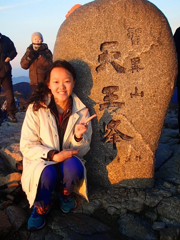
I did some hiking during my stay in South Korea, whether it is only a short hike in some trails, nevertheless, all of the trails are clearly made, easier for people especially Korean elders to do their favorite activities, trekking and hiking.
Two special mountains that I managed to hike were Jirisan and Seoraksan. San means mountain in Korean, same as Chinese.
In this article, I will try to compare these two mountains giving you insights the difference.
Also Read: Travel Guide to Seoul
Why Jirisan and Seoraksan?
Jirisan (1,915 m) is the highest mountain in mainland, second after Hallasan (1,950 m) which is located in Jeju Island.
I missed Jeju Island or else I’m gonna hike Hallasan as well. Seoraksan (1,708 m) is the most beautiful popular mountain in South Korea.
Location?
Jirisan National Park spans three provinces which are Jeollanam-do, Jeollabuk-do, Gyeongsangnam-do.
Seoraksan National Lies across multiple regions in Gangwon-do Province including Sokcho, Yangyang, and Inje.
Hiking Course?
Both mountains has many hiking courses starting from the easy one, or strenuous hiking.
It’s your choice to do which course. Some courses need to be guided. I did short courses for both mountain. For Jirisan I started through Jungsan-ni entrance, nearest big city is Jinju.
For Seoraksan, I did one day easy hike, starting from Sokcho. Click here for complete courses of Jirisan and here for Seoraksan.
Also Read: Fun Things to Do in Daegu, South Korea
Duration?
Well, it depends on which courses, what I did is short courses, so I started at 2 p.m. from the shelter and reach Jangteomok Shelter which is 4.6 kilometers away from the basecamp.
I reached the shelter around 5.30 p.m. Please note the last entry is 2 p.m. unless you stay for a night in the shelter.
For Seoraksan, I spent a day walking around the area, I did short hiking to Ulsanbawi Rock then heading to Biseondae Cliff but unfortunately it was closed.
What is your overall experience?
Based on my hike, for Jirisan hike via Jungsan-ni, it was easy, the path was clearly seen, clear directions to the peak, rocky stairs.
If you follow the direction to Jangteomok, the path is right on the side of river, so along the hike I passed lots of bridges and saw river on my side.
The shelter was clean, equipped with room heater, also there is a room for cooking but you have to bring your own cooking utensils.
On the next morning it took me around one hour to Cheonwanbong Peak, and I went down through the different trail to see Beopgyesa Temple-Rotary Shelter-Basecamp.
For Seoraksan, easy hike as well, but beware of the stairs to Ulsanbawi Rocks cause it is very steep.
At that time the wind was so strong and might be dangerous so be careful, I had to hold on tight the fence or the wind gonna swept me away.
Near the entrance there is a big Buddha statue and also a temple named Sinheungsa.
The highlight of Seoraksan is actually taking cable car to Gwongeumseong Fortress, too bad the wind was too strong so it was closed.
Also Read: Visiting Hahoe Folk Village in South Korea
Tips?
Choose the right time, from my experience I missed alot of things especially in Seoraksan because it was early winter, the wind was strong, some sites were closed, so time is really important.
Picture Time!
- Jirisan


- Seoraksan


If you think the post is useful, kindly share this information by clicking the logo below. You’ll be directed to your facebook or twitter.
Liking the content so far? If so, I would greatly appreciate your support. You can help by making a purchase through my affiliate link, which allows me to earn a commission at no extra cost to you. This support enables me to continue creating free resources like this!

Leave a Reply